Environmental & Renewables
Premise has been continually involved with the Australian resources, energy and environmental sectors throughout our lifespan. Boasting a proven track record in providing leading environmental and engineering services alongside international insights through our strategically placed offices.
Our multidisciplinary team of engineers and scientists can provide integrated ‘end-to-end’ services for resource, energy and environmental clients. Our insights mitigate project risks and maximise returns, from prefeasibility stages right through to completion.
With projects aiming to preserve, enhance and create environments that enable mutual prosperity and longevity, Premise are reliable in crafting full spectrum approaches geared for success. Considering all stages and solutions, we operate within regulatory frameworks and strive for complete project success.
Contact
IAIN McKENZIE
Business Lead | Environmental & Renewables
0466 599 068
Download | Premise Environmental & Renewables Capability Statement
Our specialities exist within:

Environmental Impact Assessment
We have expertise in project management of complex multidisciplinary environmental impact assessments and offer extensive supporting services for these projects including ecology, heritage, engineering, survey, architecture, environmental monitoring, environmental management, contaminated land, spatial analysis and mapping, and consultation with community and stakeholders.

Environmental Monitoring & Compliance
Premise excels in environmental monitoring, deploying a team of engineers and scientists for precise sampling and assessment at facilities, including dairies, abattoirs, mines, quarries, landfills and industrial operations. We engage NATA-accredited laboratories when conducting compliance and investigative monitoring, and specialise in design and implementation of environmental monitoring and management systems. Premise conducts contaminated site investigations for assessment of impacts to soil and/or groundwater. We provide from preliminary assessments to detailed investigations to remediation and validation. In line with industry standards, we assess risk levels and corresponding remedial requirements.

Ecology, Archaeology & Heritage
Our qualified team offer a wide range of services and advice that encompass both Aboriginal and Non-Aboriginal Heritage management, along with compliance to all Commonwealth, State and Local Government policy.
Premise works in collaboration to understand cultural values, significant places and ensures appropriate protection and management for matters sought by both public and private clientele.

Spatial Analysis & Mapping
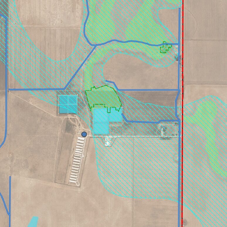
Premise can provide a variety of spatial solutions to meet the needs of your project. Geographic Information Systems (GIS) collate geographical information that can be used to identify constraints or opportunities, map sensitive areas and prepare appropriate maps or drawings to support an environmental assessment, management plan or development application. Premise can also prepare maps with drone imagery or imagery sourced via NearMap.

Solar
Climate consciousness, project success and sustainability are key drivers behind our work in the solar energy market. With an approach backed by industry expertise and experience, Premise is able to consult, plan and deliver solar services to the highest standards with ease.

Wind
Our expansive knowledge and depth of skill allows our renewables team to take on projects in the wind energy production and facility maintenance. Our services include site-evaluation, engineering, designs and project construction, all whilst guiding our client through relevant stakeholder and industry requirements.

Battery Storage
Implementing Battery Energy Storage Systems (BESS) for grid support, load levelling and microgrid backup power, Premise boasts the technical expertise to effectively guide our clients to successful outcomes.
